Most bloggers and travel companies routinely publish such lists to spike interest with their clientele. Not this one; this is my personal bucket list, with my own biases and reasons. I am a geography buff (regular in Top 10s in Quiz Up) and I love this planet because it offers so much. These places fascinate me for one reason or the other. Read on, as I share with you what I like, and also why. I have also left a tip on how to reach there, in case the Wanderlust just gets too overpowering.
Potala Palace, Lhasa

Why in my list: It is built on the hill which is supposed to be the abode of Avalokiteshwara – The Bodhi Sattva. Almost 400 years old, a UNESCO heritage site in the forbidden city of Lhasa. It has always been the winter palace of The Dalai Lama (the summer palace – Norbulingka, is OK OK…). Its been waiting for the 14th Dalai Lama to come back for 60 years now. 13 floors, 1000+ rooms, 10000 shrines, 20000 statues, rising majestically to 300m above the main road. It connects me to the feeling that there is God.
How to reach: The only international flight to Lhasa is from Kathmandu. All other flights, the most from Beijing, are from Mainland China (Shanghai, Chengdu, Xian, Guangzhou etc). Trains also connect Lhasa till Beijing. Roads are good too, with most Indians taking the road once they cross the Chinese border.
Mt. Kailash & Lake Manasarovar, Tibet Autonomous Region

Why in my list: Above 15,000 feet elevation, 2 pristine blue lakes of more than 400 sq. km each and a mountain so revered by 4 world religions (Hindus, Buddhists, Bons and Jains) that it is unclimbed so far – barring 1 disputed attempt. It is the epitome of Indian spirituality, in a part of Tibetan Plateau that is difficult to reach, made more difficult for Indians by the Chinese government. The 56 km. inner Kora (perambulation) of Mt. Kailash is the most gruelling part of this ritual – as you spend 3 days above 15,000 feet in attempt to do so. If you die, you are simply tossed over and become one with the mountain!
How to reach: Lhasa is 1400 km away and very well connected through roads till Lake Manasarovar. Foreigners can only access it through organized tour groups. There are also overland options from Nepal (1000 km) or India (Sikkim border, 1500km) through organized tours. Whatever you decide, it does take a lot of effort to reach here.
Karakoram Pass, India – China Border

Why in my list: At 18,000 feet, this pass once connected Leh (India) to Yarkand (Tarim Basin, Tibet) and was part of the original silk route. 3 days march from here down south gets you to Depsang, after which starts the inhabited Indian territories of Sasoma. Controlled by India, this place has envious neighbors like Shaksgam valley (part of Indian Kashmir, controlled and then gifted by Pakistan to China), Aksai Chin (part of Indian Kashmir, forcibly occupied by China), Siachen Glacier and the famous NJ9842 (essentially from where the international boundary isn’t demarcated). Now you understand the strategic importance of this place. It is history, living, breathing, biting.
How to reach: No one can get there, even regular Indian civilians, unless the Army agrees and provides you an OLP (outer line permit). If you get that, then your best option is to fly to Leh’s Kushak Bakula Airport at 11,000 feet and then drive down for 2 days till you get to Sasoma. Then, dial Indian Army!
Concordia, K2, Pakistan side of Kashmir

Why in my list: At 15,500 feet, it is where the Baltoro glacier and Godwin Austen (rings a bell, the guy after which people unsuccessfully tried to name K2) meet in Pakistani Karakoram. This name was given by the famous Alistair Crowley way back in 1902. It is the base for 4 of the 14 “8 thousand meter peaks in the world”, most famous of them being the mighty K2 at 8611 – though the picture above depicts the relatively easier Broad Peak (8047 meters).
How to reach: Fly to Islamabad, Pakistan and then fly to Skardu, weather permitting. Else, drive down to Skardu (17 hours, 650km on the famous Chinese built Karakoram highway). Thereafter, by jeeps to Askole and then 7-8 days trek on feet to reach Concordia. Indians can almost write this off their wishlist.
Easter Island, South Pacific Ocean, Chile

Why in my list: Rapa Nui, as it is also called, is one of the world’s most isolated inhabited islands. 1850km from its host country Chile, in the South Pacific Ocean, this place is perhaps closest to Point Nemo – the point in our Ocean’s which is farthest from any land mass – also known as our 3rd Pole. I am not sure how the Polynesians (evidence tells us these dudes came from Taiwan that time) arrived here first some 800 years ago, but they seemed very determined and industrious – creating these super huge statues – as many as 887 of these. The Europeans were biting their nails at the awe of these statues when they landed here in 1700s.
How to reach: Only 1 daily flight of 6 hours from Santiago, the capital of Chile, and 1 weekly flight from neighboring Tahiti (5 hours). Also, you can take a Voyager Ship ticket that sails from New Zealand and gets you there in 35 days. Cool!
Jerusalem, Israel
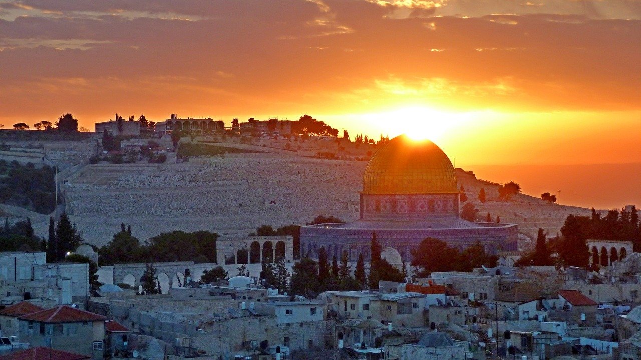
Why in my list: I have always listed Jerusalem in my head as the cradle of civilization and religion. much before Rome became the center of the world, Adam, David, Solomon et al had shown just what Jerusalem meant. I was converted after I read “Jerusalem” by Simon Sebag Montefiore. Undoubtedly one of oldest inhabited cities of the world, and claimed by 3 very tall religions – Jews, Christians and Muslims – it is bound to have the bloody past that it has, and continues to have – destroyed twice, besieged 23 times, recaptured 44 times, attacked 52 times.
How to reach: Much easier. Get to Tel Aviv’s Ben Gurion International Airport and Jerusalem is a 90 min drive from there.
Pitcairn Islands, South Pacific Ocean, UK
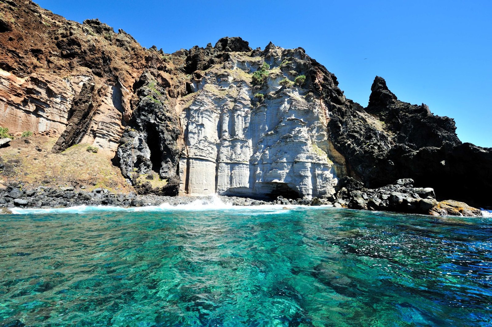
Why in my list: 5500km from New Zealand are these 4 volcanic islands, deep in remote Pacific Ocean that is Britain’s only Collectivity in the Pacific. They are scattered over hundreds of ocean miles and put together are only 47 sq. km in territory, with a population of 50. British governments paid incentives for people to go settle there hasn’t added a single inhabitant across the years. Most citizens are descendants of the 9 mutineers aboard the HMS Bounty. Its remoteness is just one aspect that fascinates. I haven’t been there but have read almost everywhere that these islands are the most beautiful in the world.
How to reach: There is no airport as islands aren’t big. The best and expensive way to get there is to take once a week 4 hour flight from Tahiti to nearest Mangareva (650 km away) and then charter a sea vessel and reach in 32 hours – or wait for the once in 3 months common Ship that plies between Mangareva and Pitcairns, which still takes 32 hours!
Angel Falls, Venezuela

Why in my list: It is the world’s highest uninterrupted waterfall at close to 1000m of drop. The majesty of standing at the base of the fall and looking upwards to as high as a kilometer and only find water steaming down is a sight of a lifetime. Sir Walter Raleigh, traveling in his search for the mythical Eldorado, perhaps discovered it for the modern world in the 17th century. Located inside an isolated jungle in Amazonian Venezuela, getting there is a difficult journey through remotely civilized places and meandering rivers.
How to reach: You have to get to the town of Canaima in Venezuela. Given it’s remoteness, you can only get to Canaima by flights – either from Ciudad Bolivar or Puerto Ordaz (90 min flights). If you fly through Ciudad Bolivar, you can get a good aerial glimpse of the Angel. From Canaima, it is a 5 hour boat ride to Rio Carrao, and then ~4 hours walk to get to the Falls. You return back to camps at Canaima.
Mt. Fitz Roy, Patagonia, Chile &Argentina
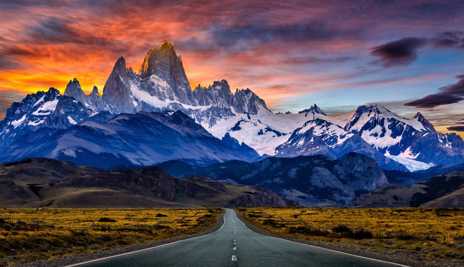
Why in my list: This handsome and one of the most technically difficult to climb mountain in the world, is in the southern Patagonian ice fields of Chile & Argentina. It was first climbed by Leo Terray (from the famous adventure party of Maurice Herzog who were the first summiters of the deadly Annapurna in their first attempt itself – these are legends). Its a beauty from whichever side you see it from. No wonder it stands as an emblem for the Patagonian region itself. The good part is, that its base can be easily trekked in a day tour; and it perhaps is the most beautiful day-trek in the world.
How to reach: You have to get to the tiny town of El Chalten in Argentina to trek this beauty. You get there by taking a 3 hour bus ride from El Calafete. Flights from Buenos Aires (2.5hrs) connect El Calafete to the world. Walk to the Fitz Roy trailhead in El Chalten and follow the people. It will be a 9 hour round trip to the base of Fitz Roy and back (overall 40km trek amidst jaw dropping beauty)
Diomede Islands, Bering Strait (US or Russia side)

Why in my list: Located in the Bering Strait (from where the international date line crosses), between Alaska and Siberia are 2 islands – Big Diomede (owned by Russia) and Little Diomede (owned by US). The 2 islands are just 3.8km apart, but Big D is 1 day ahead in time compared to Little D – well, actually only 21 hours ahead. Hell freezes over in winters as you can see both these islands in the picture above (summers are 4C and winters -14C). Russians vacate Big D during winters but Americans stay put in Little D the year over. As for me, I’d like to be in the middle of the two islands, constantly adjusting my watch.
How to reach: The islands are so remote that even the first state official who arrived here, arrived in 2002 (the Senator from Alaska, who after landing commented that “this is so remote”). Bering Air flies from Nome, Alaska to Little D in winters. Planes land on ice. Choppers also operate thru the year. Getting legally to Big D from Russian side is not possible.

